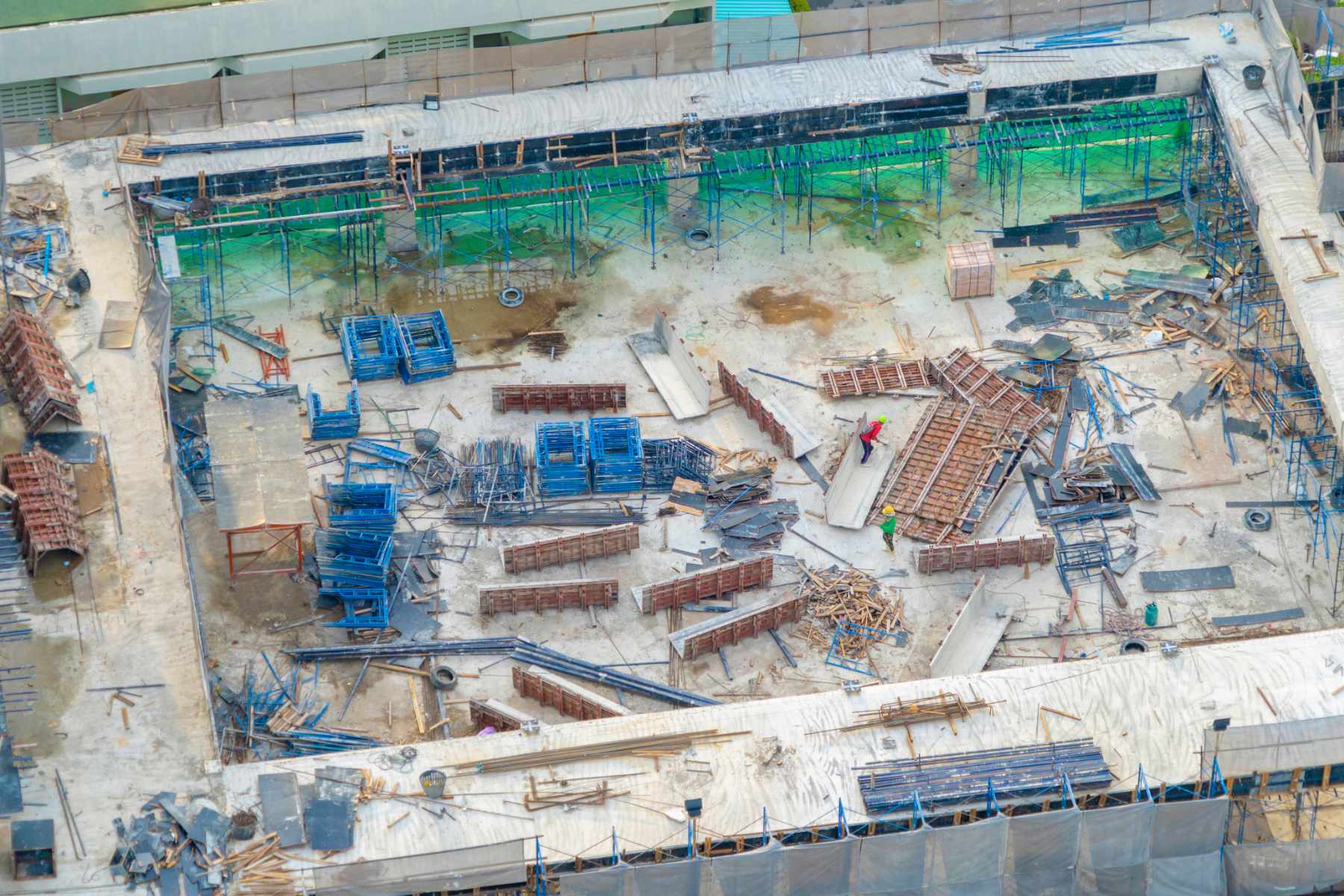
Advancements in drone technology and artificial intelligence have become increasingly invaluable for construction projects. Drones not only offer a unique perspective by capturing aerial images and videos of construction progress, but they also serve as a crucial tool for inventory tracking. By leveraging artificial intelligence, drones can accurately identify and monitor material quantities, helping to streamline the management of supplies and reduce wastage.
Moreover, the integration of AI with drones enhances the accuracy of invoicing processes by automating the validation of delivered materials against invoices. This automation reduces human error and enhances efficiency. Additionally, utilizing drones to document project sites can significantly decrease the likelihood of litigation by providing comprehensive visual evidence that is more reliable than traditional cell phone photographs.
Drones can help construction companies with:
- Investor Updates & Progress Reporting
- Tracking Inventory
- Increasing Invoice Accuracy
- Increasing Accuracy of 3D Models
- Safer Site Inspections
- Reducing Risk of Litigation
- Marketing Materials for Print & Web
- Site Mapping
Drone mapping has revolutionized the construction industry by providing accurate and real-time aerial data of project sites. Construction companies are using drones equipped with high-resolution cameras to capture detailed images and topographical information, allowing for precise monitoring of progress and identifying potential issues. The use of drones in mapping also enhances safety by eliminating the need for workers to physically access hazardous or hard-to-reach areas.
Additionally, drone mapping helps streamline workflow processes by generating 3D models and digital terrain maps, which support better project planning and resource allocation. These maps contribute to improved project coordination as they provide a comprehensive view of the entire site, enabling stakeholders to make informed decisions quickly. Moreover, the cost efficiency of using drones for mapping cannot be overstated, as it reduces the need for costly aerial surveys and time-consuming manual data collection.
In summary, combining drone technology with artificial intelligence has proven to be transformative for construction projects, offering improved monitoring capabilities, enhanced accuracy in inventory tracking, streamlined invoicing processes, and reduced legal risks.